By KDH Productions – FAA Part 107-licensed aerial studio
Flying near Pensacola? See exactly where drones are grounded from the airport’s Class-C shelf to surprise hurricane TFRs and learn how to secure rapid LAANC approval or book a fully-insured aerial shoot with KDH Productions.

Coordinates are approximations; always verify live airspace status in the B4UFLY or Aloft app before every flight.
Why No-Fly Zones Matter for Gulf-Coast Shoots
A single take-off inside restricted airspace can trigger civil fines up to $15,000, equipment seizure, or worse: scrapped footage and missed listing deadlines. Military bases, hurricane TFRs, and local park ordinances blanket much of the Pensacola metro in “red zones” you’ll see in the FAA’s B4UFLY app. faa.gov
Mapping Pensacola’s Controlled Airspace
- Class-C “shelf” – 5-nautical-mile (NM) radius around Pensacola International (KPNS) and NAS Pensacola; ceiling heights step from 0–400 ft in the FAA’s UAS Facility Map. faa.gov
- LAANC authorization required for any commercial flight inside these rings.
- Automatic denials inside the 0 ft grids; everything else may approve instantly up to the posted ceiling.
Tool tip: Tap any cell in B4UFLY the pop-up gives altitude, airspace class, and a shortcut to the LAANC portal. faa.gov
Military Exclusion: NAS Pensacola & Whiting Field
NAS Pensacola operates under a permanent No-Drone Zone visualized as a hard-red core on both B4UFLY and ArcGIS layers. The base’s public-safety office confirms that no civil UAS waivers are granted inside this inner 2 NM radius. naspcus.com
- Whiting Field (NOLF) adds a second Class-C shelf over nearby Milton; expect the same zero-tolerance rule set.
- Signage posted on beaches near the base carries the FAA’s No Drone Zone icon. faa.gov
State & City Ordinances You Might Overlook
Florida and Alabama both lean stricter than federal baselines:
| Jurisdiction | Rule | Source |
|---|---|---|
| Florida State Parks | Total take-off / landing ban without written ranger approval | (uavcoach.com) |
| Alabama State Parks | Same ban; permits available for “documentary or news” only | (uavcoach.com) |
| Crowds >1,000 | Special-event TFR or local city permit required (e.g., Blue Angels Air Show) | (uavcoach.com, faa.gov) |
Bottom line: even with LAANC, you must still secure land-use permission.
Temporary Flight Restrictions (TFRs) & Hurricane Season
Between June 1 and November 30 the Gulf often sees disaster-response TFRs that pop up with a few hours’ notice. The FAA publishes them as NOTAMs; flying without waiver can lead to federal charges. faa.gov
Check-list:
- Open B4UFLY → NOTAM toggle
- Verify no TFRs for hurricane recovery or VIP movement
- Screenshot the green “Clear to Fly” status for your records
Getting LAANC Approval in Class-C Airspace
- Launch Aloft or OpenSky (LAANC-approved apps).
- Enter address → app returns ceiling (0–400 ft).
- File request for desired altitude ≤ ceiling.
- Get instant authorization e-mail.
Pro tip: If the grid displays 0 ft, choose an alternate take-off site outside the cell; even the FAA can’t approve 0 ft grids without a manual waiver, which takes up to 90 days. faa.gov
Real-World Scenarios
| Shoot Type | Compliance Path | Why |
|---|---|---|
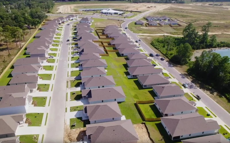
| Ocean-view listing on Pensacola Beach | Outside Class-C; Florida Park ban applies → request ranger permit or launch from private lot | State-park rule trumps airspace |
| Downtown high-rise reveal | Within 300-ft ceiling grid → file LAANC, stay ≤300 ft AGL | KPNS shelf |
| Sport-fishing promo 3 NM offshore | Uncontrolled Class E; no LAANC | Water launch avoids land-use issues |
| Sunset dolphin-cruise B-roll | Same as above plus follow Coast Guard “see-and-avoid” | Maritime safety |
Working With KDH: Compliance, Insurance, & Same-Day Waivers
- Part 107-certified pilots – trust exam + recurrent HQ.
- $2 M liability coverage – certificate delivered with your proposal.
- Automated LAANC filing – we handle in-app paperwork while scouting.
- Same-day COI – many marinas demand insurance to board.
- Data-secure – RAW footage stored on encrypted SSDs.
Explore Aerial Packages | Need sky-high footage without a sky-high fine? Book today
Pensacola No-Fly FAQ
Can I launch a drone from Pensacola Beach?
Only from private property. The public beach falls under state-park jurisdiction, which bans take-offs and landings without ranger approval.
Why does B4UFLY show a red ring even after LAANC approval?
Red indicates a land-use take-off/landing ban or a 0 ft grid. Airspace authorization does not override property restrictions.
Do hurricane TFRs ban all drones?
No. They prohibit unauthorized flights; properly credentialed crews can request emergency waivers for relief work.
Need sky-high footage without a sky-high fine? Book your compliant drone shoot today or call (850) 898-2234 for next-day availability.